ANZMetLite v2 Help
View the Project on GitHub OpenWork-NZ/ANZLIC-Metadata-Tool-help
Spatial Tab
The Spatial page consist of three separate sections.
- Extents - Used for discovery purposes. Holds common term description of the the area of earth to which the resource pertains.
- Resolution - Provides a guide to the spatial scale at which the resource is meant to be used.
- Reference System - Holds information about the standardised parameters used to store location information.
Extents
Description
Written explanation of the spatial and temporal extents of the resource
- ICSM Guidance - https://icsm-au.github.io/metadata-working-group/defs/ExtentGeographicDescription
- Optional field to be used when verbal descriptions help explain the extents of a resource.
- When no text is present, clicking the boxed “+” under Description exposes a text box to populate.
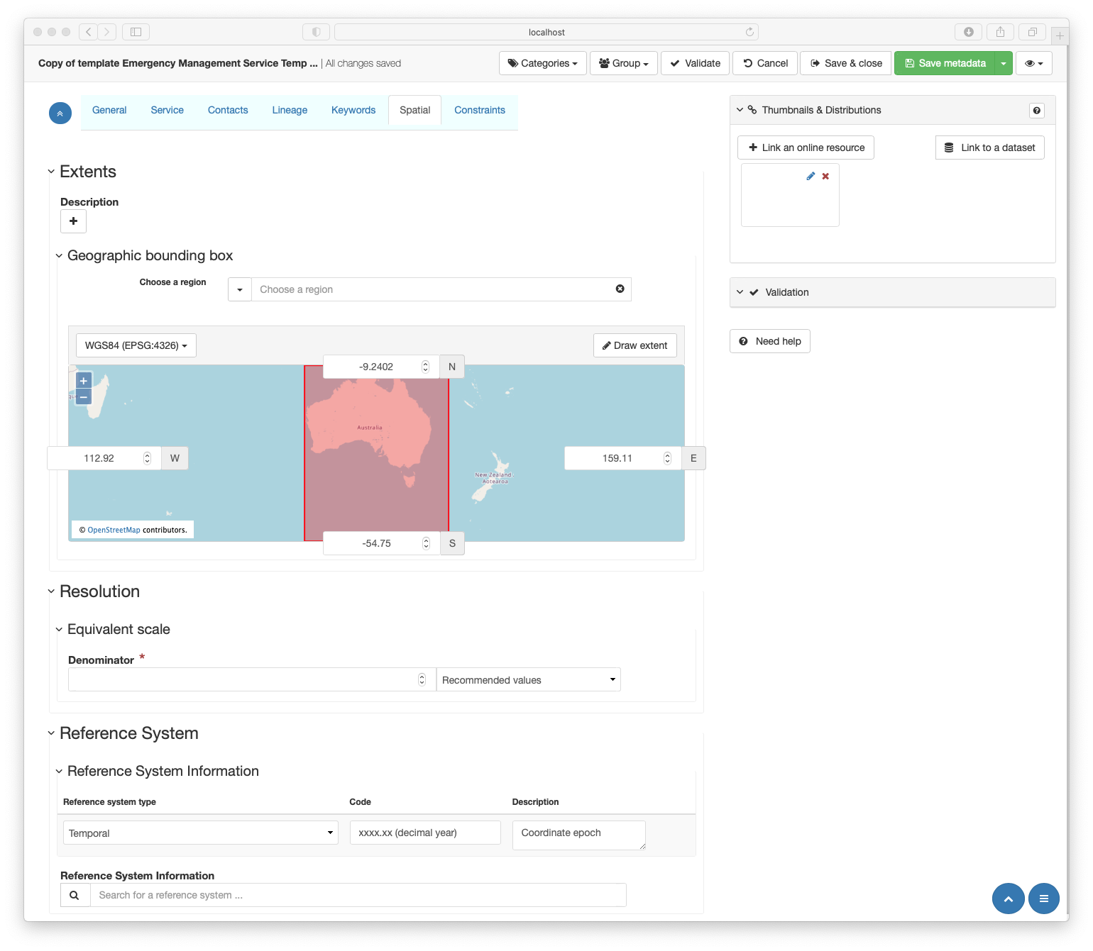
Geographic bounding box
Four values which define a box containing the resource area of relevance
- ICSM Guidance - https://icsm-au.github.io/metadata-working-group/defs/ExtentBoundingBox
- Geographic extents may be populated via two mechanisms
- Choose a region - provides a search box against a selected source and displays this on the map.
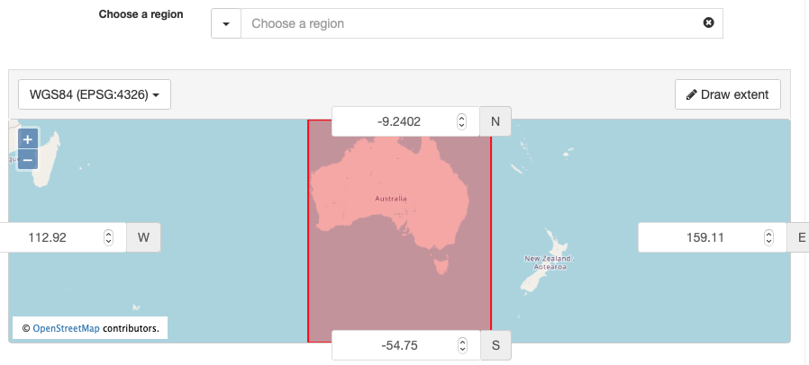
NOTE: the geonames option is slow but comprehensive. The other reference internal files and are much quicker.
- The map may be directly edited by
- Entering and adjusting coordinate values
NOTE: The CRS for this map is stated in the upper right dropdown. This should be left as “WGS 84 (EPSG:4326)”.
- Manually drawing extents by selecting the Draw extents button in the upper right and then navigating to you desired location and clicking and dragging a box over the desired location
NOTE: If multiple, polygonal or other extents are needed, expert users can do so in the Advanced metadata editing interface.
- Entering and adjusting coordinate values
- Choose a region - provides a search box against a selected source and displays this on the map.
Resolution
Equivalent scale
Level of detail expressed as the scale of a comparable hardcopy map or chart
- ICSM Guidance - https://icsm-au.github.io/metadata-working-group/defs/SpatialResolution
- Each metadata record for a spatial resource Must include an Equivalent scale.
- The Recommended values dropdown to the right provides a useful list of common values to select.
- Values can be adjusted or entered free form in the Denominator box.
Reference system
Reference System Information
Displays a table of reference systems applicable to the resource
- ICSM Guidance - https://icsm-au.github.io/metadata-working-group/defs/SpatialReferenceSystem.html
- A partially completed Coordinate epoch entry provides a way to capture information needed to account for coordinate drift due to earth plate techtonics.
- The date Should hold, in decimal year format, the date of which the coordinates used were captured.
- Reference system type and Description prepopulated values Should remain.
- Appropriate additional references systems Must be added
- Use the Search for a reference system dialogue to select from a prepopulated list of applicable CRS
- Search using the dropdown or
- The extended search available by clicking the spyglass icon

- Additional CRS values may be added using the Advanced interface.
- Add as many or few CRS as needed to describe the resource.
- Use the Search for a reference system dialogue to select from a prepopulated list of applicable CRS